Приложения
- Арт дизайн
- Авто и транспорт
- Красота
- Книги и справочники
- Бизнес
- Комиксы
- Связь
- Знакомства
- Образование
- Развлечения
- События
- Финансы
- Еда и напитки
- Здоровье и фитнес
- Дом
- Разное
- Стиль жизни
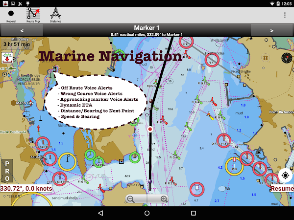
- Карты и навигация
- Медицина
- Музыка и аудио
- Новости и журналы
- Воспитание
- Персонализация
- Фотография
- Работа
- Покупки
- Социальные
- Спорт
- Инструменты
- Путешествия
- Видеоплееры и редакторы
- Погода
Игры

комментарии